‘Shelf Cloud’ : Rare Cloud Phenomenon in Bahrain: ‘Shelf Cloud’ Spotted
A rare shelf cloud was observed in the skies over Bahrain early this morning during intense thunderstorms and heavy rainfall.
Rare Cloud Phenomenon in Bahrain: ‘Shelf Cloud’ Spotted
A rare shelf cloud was observed in the skies over Bahrain early this morning during intense thunderstorms and heavy rainfall. Prominent physicist Prof. Dr. Waheeb Essa Al Nasser reported the sighting, noting that this type of cloud typically forms ahead of strong storm systems and signals significant changes in weather conditions.
What is a Shelf Cloud?
A shelf cloud is a type of low-hanging, horizontally extended, dense cloud formation. It usually appears at the leading edge of large thunderstorm systems known as cumulonimbus clouds. Visually, it looks like a massive shelf or slab hanging across the sky, often indicating that a storm is approaching.
How Does a Shelf Cloud Form?
Shelf clouds form under specific atmospheric conditions:
• Warm air rises rapidly upward.
• At the same time, cold air from the storm (downdraft) rushes downward.
• This cold air spreads forward and lifts the warm air ahead of it.
At the boundary where these air masses meet, the shelf cloud forms. This area is commonly referred to as the gust front.
What Does It Indicate?
The appearance of a shelf cloud is usually a warning sign of sudden weather changes. It may be followed by:
• Strong, gusty winds
• Sudden drop in temperature
• Heavy rainfall
• Thunderstorms and lightning
The severe rain and thunderstorms experienced in Bahrain today were consistent with this phenomenon.
Need for Continued Caution
Authorities have warned that unstable weather conditions may continue in Bahrain over the coming days. Due to the risk of strong winds and lightning:
• Avoid unnecessary travel
• Follow official safety guidelines
While a shelf cloud can be a stunning natural sight, it also signals potentially dangerous weather. Therefore, caution is essential whenever such clouds are observed.
Kerala Weather 30/04/26 : കേരളത്തിൽ ഇന്നും മഴ സാധ്യത ; മഞ്ഞ അലർട്ടുകൾ പ്രഖ്യാപിച്ചു
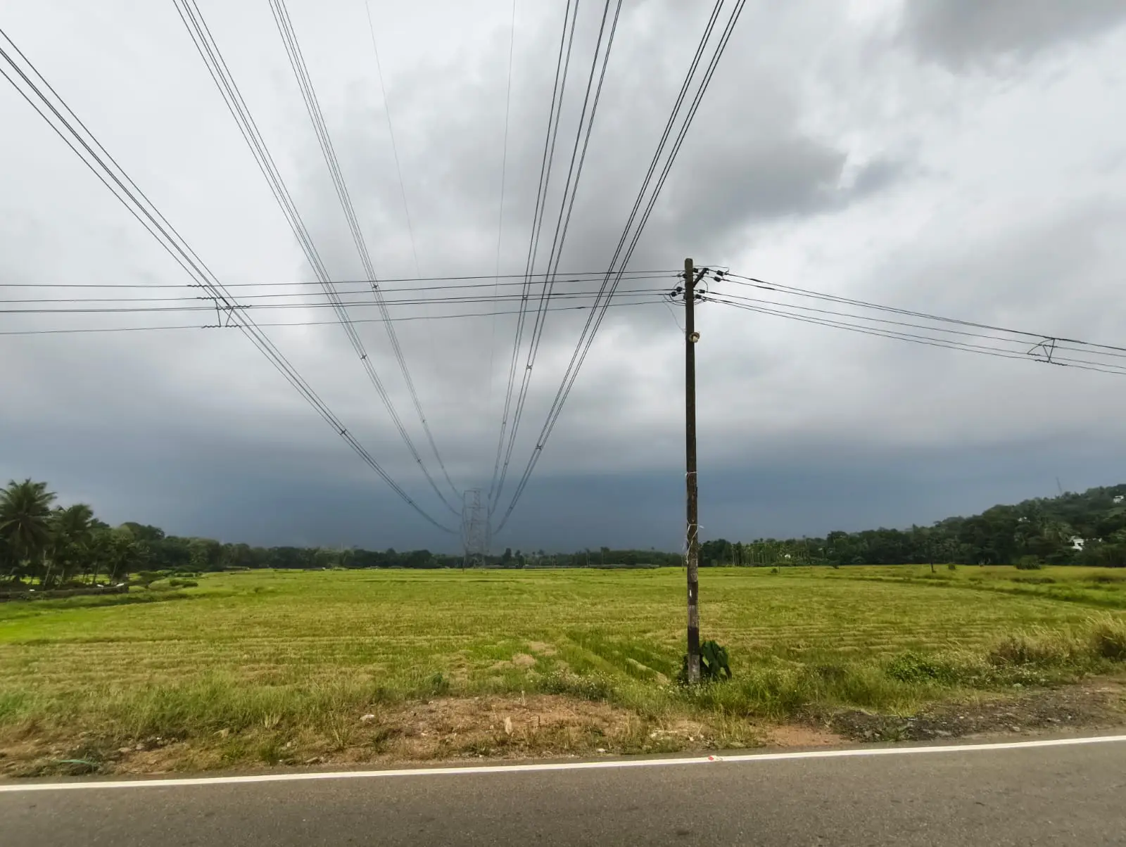
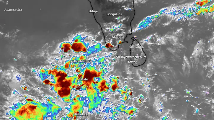
കടുത്ത ചൂടിന് ആശ്വാസമായി കേരളത്തിൽ ഇന്നും (വ്യാഴം ) വേനൽ മഴയ്ക്ക് സാധ്യത. ഇടുക്കി, കണ്ണൂർ, കാസർഗോഡ് ജില്ലകളിൽ ഇന്ന് ശക്തമായ മഴയ്ക്കുള്ള യെല്ലോ മുന്നറിയിപ്പ് (Yellow alert) കേന്ദ്ര കാലാവസ്ഥ വകുപ്പ് നൽകിയിട്ടുണ്ട്.
മണിക്കൂറിൽ 50 കിലോമീറ്റർ വരെ വേഗതയിൽ കാറ്റ് വീശാനും സാധ്യതയുണ്ട്. അതേസമയം, പുറത്തുനിന്ന് വൈദ്യുതി ലഭിക്കുന്നതോടൊപ്പം വേനൽ മഴയും ലഭിക്കുന്നതോടെ ലോഡ്ഷെഡ്ഡിങ്ങ് വേണ്ടിവരുന്നില്ലെന്നാണ് KSEB വിലയിരുത്തൽ. എങ്കിലും പലയിടത്തും വൈദ്യുതി തടസം ഉണ്ട്.
വേനൽ മഴ ലഭിച്ചതോടെ സംസ്ഥാനത്ത് താപനിലയിൽ നേരിയ കുറവ് രേഖപ്പെടുത്തിയിട്ടുണ്ട്. ശക്തമായ മഴയിലും കാറ്റിലും ഇടുക്കിയിലും മറ്റ് സ്ഥലങ്ങളിലും നാശനഷ്ടങ്ങൾ ഉണ്ടായി. മെയ് രണ്ട് വരെ ശക്തമായ വേനൽ മഴയുണ്ടാകുമെന്ന് കാലാവസ്ഥ വകുപ്പ് വ്യക്തമാക്കി.
അതേസമയം, വടക്കൻ ജില്ലകളിൽ കടുത്ത ചൂടാണ് അനുഭവപ്പെടുന്നുണ്ട്. പാലക്കാട് ജില്ലയിൽ രേഖപ്പെടുത്തിയ താപനില 39.3 ഡിഗ്രി സെൽഷ്യസ് ആണ്. കോഴിക്കോട് ജില്ലയിലും ഉയർന്ന താപനിലയായ 37. 9 ഡിഗ്രി സെൽഷ്യസ് രേഖപ്പെടുത്തി. 12 ജില്ലകൾക്ക് നൽകിയിരുന്ന യെല്ലോ മുന്നറിയിപ്പ് പിൻവലിച്ചിട്ടുണ്ട്.
വടക്കൻ കേരളത്തിൽ കാലാവസ്ഥ വകുപ്പ് മുന്നറിയിപ്പ് നൽകിയിട്ടുണ്ടെങ്കിലും വ്യാപകമായ വേനൽ മഴ ലഭിക്കാനുള്ള സാധ്യത കുറവാണ്. കഴിഞ്ഞദിവസം തെക്കൻ ജില്ലകളിൽ ലഭിച്ചത് പോലുള്ള വടക്കൻ കേരളത്തിൽ പ്രതീക്ഷിക്കേണ്ട. എങ്കിലും ഒറ്റപ്പെട്ട മഴ ലഭിക്കും.
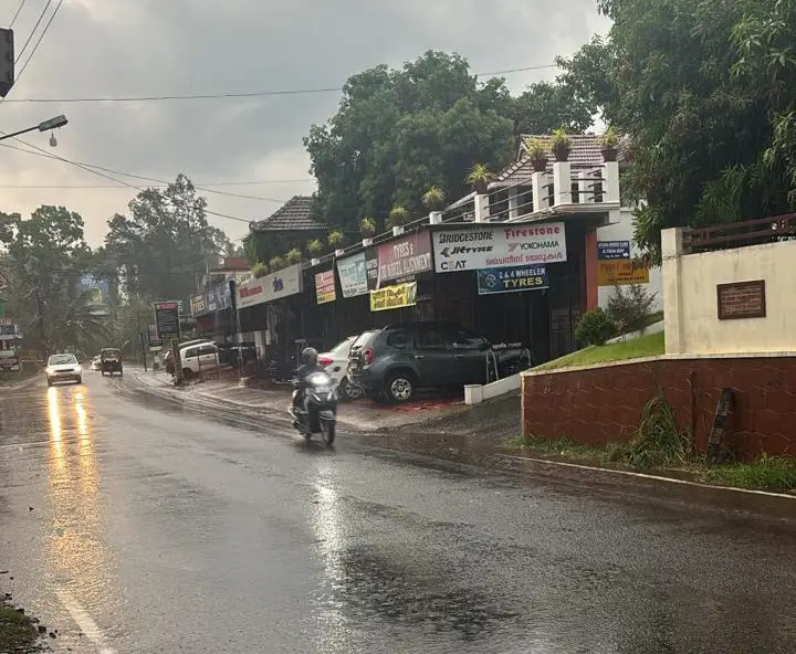
കോട്ടയം ജില്ലയിൽ ഇന്നലെ ശക്തമായ മഴ പെയ്തു. കാറ്റിലും മഴയിലും നാശനഷ്ടം ഉണ്ടായി. കോട്ടയം ജില്ലയിൽ വീട് ഭാഗങ്ങളിൽ ഇന്ന് രാവിലെ 8 30 വരെ മഴയുടെ കണക്ക്. മീനച്ചിൽ റെയിൻ റിവർ മേണിറ്റിറിംഗ് നെറ്റ് വർക്കിൻ്റെ മാപിനികളിൽ രേഖപ്പെടുത്തിയത്.
Meenachil River and Rain Monitoring Network
MRRM
Rainfall (mm)
2026 April 30 at 8.30 am (Last 24 hours)
✔️Poonjar Thekkekara panchayat
✅Kunnonny Pottankudy 13.6
✅Peringulam Chattampi 62.60
✅Kadaladimattam Oliyani 19.60
✅Pathampuzha 9.00
✅Poonjar Thekkekara Town 25.20
✔️Meenachil panchayat
✅Parappally 17.08
✅Pankapattu 45.4
✔️Pala municipality
✅Pala 19.63
✅Kannadiyurumbu 25.6
✅Arunapuram 8.6
✅12th mile 14.4
✔️Melukavu panchayat
✅Melukavu 15.67
✔️Thidanad panchayat
✅Chemmalamattam 10.40
✅Pathazha 52.3
✅Uttupara 14.2
✔️Bharananganam panchayat
✅Bharananganam 63.20
✅Ullanad 17.8
✔️Moonnilavu panchayat
✅Mankombu Temple Anganvadi 26.42
✔️Kidangoor panchayat
✅Kattachira
4.4
✔️Poonjar panchayat
✅Valathook 9
✅Maniamkunnu 15.6
✅Chennad 5.8
✔️Thalappalam panchayat
✅Narianganam 38.4
✔️Teekoy panchayat
✅Eriyattupara 59.6
✅Kattupara 21.6
✔️Erattupetta
✅kondoor 68.2
English Summary : Relief from Heat as Summer Rains Lash Kerala. The recent summer showers have brought a slight dip in temperatures across Kerala, providing much-needed relief from the intense heat. However, the heavy rains accompanied by strong winds have also caused significant damage in several areas, including Idukki. The Meteorological Department has issued a forecast stating that strong summer rains are expected to continue through May 2nd.