US Weather : New Weather Threat in the United States: Risk of Flooding from Ice Jams as Temperatures Rise Sharply
The powerful blizzard of 2026 that affected the eastern parts of the United States has now become one of the most significant weather events
New Weather Threat in the United States: Risk of Flooding from Ice Jams as Temperatures Rise Sharply
The powerful blizzard of 2026 that affected the eastern parts of the United States has now become one of the most significant weather events in recent history. A blizzard is a dangerous weather phenomenon characterized by heavy snowfall accompanied by extremely strong winds and very low visibility.
According to weather department data, several areas in the northeastern states recorded an average snowfall of around 32 inches. In some regions, winds reached speeds of up to 80 miles per hour, causing major disruptions to transportation systems and electricity services.
However, weather experts warn that the problems have not ended with the blizzard. As the snow and river ice begin to melt, the Northeast and Midwest regions of the United States are now facing the risk of ice jams.
This warning was issued in a report released by the weather research organization AccuWeather. The report states that rivers stretching from upstate New York to New England may experience ice jams in the coming days due to melting snow and ice. An ice jam occurs when chunks of ice floating in a river accumulate and block the natural flow of the water.
When this happens, water can suddenly back up and later surge forward, which may lead to unexpected flooding. Experts warn that people living along riverbanks and in low-lying areas face a significant risk from such events.
Multiple sectors may be affected
The report also notes that transportation systems, supply chains, and local services could face disruptions due to potential flooding. The risk is expected to continue until mid-March.
At the same time, meteorologists predict that temperatures across many parts of the United States will rise sharply above normal levels in the coming days.
According to research by AccuWeather, temperatures across the Midwest and Northeast could climb 15 to 25 degrees Fahrenheit above historical averages during the weekend.
Warmest days expected
Some cities may experience their warmest temperatures since last fall. In Pittsburgh, Pennsylvania, temperatures are forecast to reach between the mid-60s and mid-70s Fahrenheit, which could be the warmest conditions since October.
In Chicago, Illinois, temperatures are expected to reach around 70°F during the first week of March. Detroit, Michigan, is also likely to experience similar warmth. The warm air will then spread to the Northeast, with New York City expected to see temperatures around 60°F.
Rain, hail, and severe storms
Meanwhile, parts of the central United States are preparing for severe thunderstorms, hail, flash flooding, and possible tornadoes over the weekend, according to weather monitoring agencies.
As Americans attempt to recover from the impact of the recent blizzard, new weather challenges are already emerging across the country.
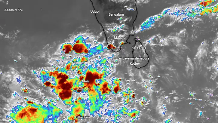
Kerala Weather 30/04/26 : കേരളത്തിൽ ഇന്നും മഴ സാധ്യത ; മഞ്ഞ അലർട്ടുകൾ പ്രഖ്യാപിച്ചു
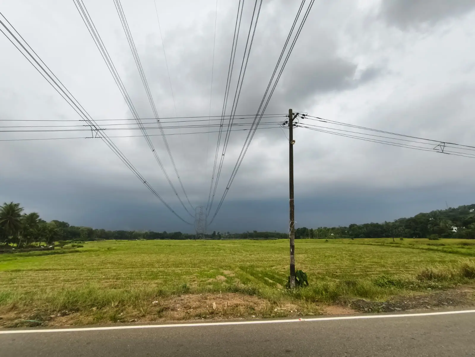
കടുത്ത ചൂടിന് ആശ്വാസമായി കേരളത്തിൽ ഇന്നും (വ്യാഴം ) വേനൽ മഴയ്ക്ക് സാധ്യത. ഇടുക്കി, കണ്ണൂർ, കാസർഗോഡ് ജില്ലകളിൽ ഇന്ന് ശക്തമായ മഴയ്ക്കുള്ള യെല്ലോ മുന്നറിയിപ്പ് (Yellow alert) കേന്ദ്ര കാലാവസ്ഥ വകുപ്പ് നൽകിയിട്ടുണ്ട്.
മണിക്കൂറിൽ 50 കിലോമീറ്റർ വരെ വേഗതയിൽ കാറ്റ് വീശാനും സാധ്യതയുണ്ട്. അതേസമയം, പുറത്തുനിന്ന് വൈദ്യുതി ലഭിക്കുന്നതോടൊപ്പം വേനൽ മഴയും ലഭിക്കുന്നതോടെ ലോഡ്ഷെഡ്ഡിങ്ങ് വേണ്ടിവരുന്നില്ലെന്നാണ് KSEB വിലയിരുത്തൽ. എങ്കിലും പലയിടത്തും വൈദ്യുതി തടസം ഉണ്ട്.
വേനൽ മഴ ലഭിച്ചതോടെ സംസ്ഥാനത്ത് താപനിലയിൽ നേരിയ കുറവ് രേഖപ്പെടുത്തിയിട്ടുണ്ട്. ശക്തമായ മഴയിലും കാറ്റിലും ഇടുക്കിയിലും മറ്റ് സ്ഥലങ്ങളിലും നാശനഷ്ടങ്ങൾ ഉണ്ടായി. മെയ് രണ്ട് വരെ ശക്തമായ വേനൽ മഴയുണ്ടാകുമെന്ന് കാലാവസ്ഥ വകുപ്പ് വ്യക്തമാക്കി.
അതേസമയം, വടക്കൻ ജില്ലകളിൽ കടുത്ത ചൂടാണ് അനുഭവപ്പെടുന്നുണ്ട്. പാലക്കാട് ജില്ലയിൽ രേഖപ്പെടുത്തിയ താപനില 39.3 ഡിഗ്രി സെൽഷ്യസ് ആണ്. കോഴിക്കോട് ജില്ലയിലും ഉയർന്ന താപനിലയായ 37. 9 ഡിഗ്രി സെൽഷ്യസ് രേഖപ്പെടുത്തി. 12 ജില്ലകൾക്ക് നൽകിയിരുന്ന യെല്ലോ മുന്നറിയിപ്പ് പിൻവലിച്ചിട്ടുണ്ട്.
വടക്കൻ കേരളത്തിൽ കാലാവസ്ഥ വകുപ്പ് മുന്നറിയിപ്പ് നൽകിയിട്ടുണ്ടെങ്കിലും വ്യാപകമായ വേനൽ മഴ ലഭിക്കാനുള്ള സാധ്യത കുറവാണ്. കഴിഞ്ഞദിവസം തെക്കൻ ജില്ലകളിൽ ലഭിച്ചത് പോലുള്ള വടക്കൻ കേരളത്തിൽ പ്രതീക്ഷിക്കേണ്ട. എങ്കിലും ഒറ്റപ്പെട്ട മഴ ലഭിക്കും.
കോട്ടയം ജില്ലയിൽ ഇന്നലെ ശക്തമായ മഴ പെയ്തു. കാറ്റിലും മഴയിലും നാശനഷ്ടം ഉണ്ടായി. കോട്ടയം ജില്ലയിൽ വീട് ഭാഗങ്ങളിൽ ഇന്ന് രാവിലെ 8 30 വരെ മഴയുടെ കണക്ക്. മീനച്ചിൽ റെയിൻ റിവർ മേണിറ്റിറിംഗ് നെറ്റ് വർക്കിൻ്റെ മാപിനികളിൽ രേഖപ്പെടുത്തിയത്.
Meenachil River and Rain Monitoring Network
MRRM
Rainfall (mm)
2026 April 30 at 8.30 am (Last 24 hours)
✔️Poonjar Thekkekara panchayat
✅Kunnonny Pottankudy 13.6
✅Peringulam Chattampi 62.60
✅Kadaladimattam Oliyani 19.60
✅Pathampuzha 9.00
✅Poonjar Thekkekara Town 25.20
✔️Meenachil panchayat
✅Parappally 17.08
✅Pankapattu 45.4
✔️Pala municipality
✅Pala 19.63
✅Kannadiyurumbu 25.6
✅Arunapuram 8.6
✅12th mile 14.4
✔️Melukavu panchayat
✅Melukavu 15.67
✔️Thidanad panchayat
✅Chemmalamattam 10.40
✅Pathazha 52.3
✅Uttupara 14.2
✔️Bharananganam panchayat
✅Bharananganam 63.20
✅Ullanad 17.8
✔️Moonnilavu panchayat
✅Mankombu Temple Anganvadi 26.42
✔️Kidangoor panchayat
✅Kattachira
4.4
✔️Poonjar panchayat
✅Valathook 9
✅Maniamkunnu 15.6
✅Chennad 5.8
✔️Thalappalam panchayat
✅Narianganam 38.4
✔️Teekoy panchayat
✅Eriyattupara 59.6
✅Kattupara 21.6
✔️Erattupetta
✅kondoor 68.2
English Summary : Relief from Heat as Summer Rains Lash Kerala. The recent summer showers have brought a slight dip in temperatures across Kerala, providing much-needed relief from the intense heat. However, the heavy rains accompanied by strong winds have also caused significant damage in several areas, including Idukki. The Meteorological Department has issued a forecast stating that strong summer rains are expected to continue through May 2nd.