UAE Weather : Rain Surges Across Desert Nations; Gulf Region in Distress, Now to Europe
An unusual weather pattern that developed across the Middle East last week triggered severe thunderstorms and widespread damage.
Rain Surges Across Desert Nations; Gulf Region in Distress, Now to Europe
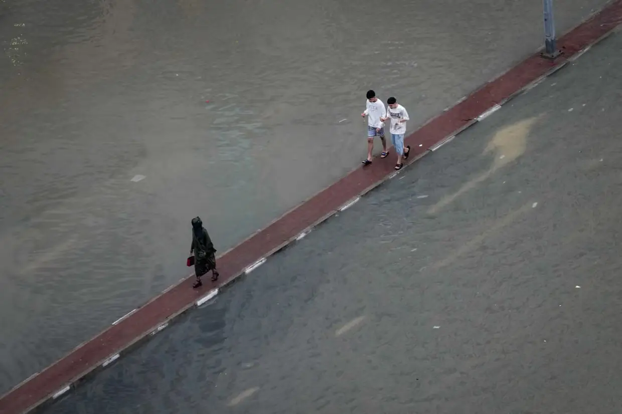
An unusual weather pattern that developed across the Middle East last week triggered severe thunderstorms and widespread damage. Countries including the United Arab Emirates and Saudi Arabia were significantly affected. The Arabian Peninsula, typically dominated by an arid climate, received up to 150 mm of rainfall within just a few days—an extremely rare occurrence.
The primary cause of this intense rainfall was an unusually strong jet stream (Jet Stream). This led to the formation of a deep low-pressure system over northern Saudi Arabia.
This system pulled in moisture-laden tropical air from the Indian Ocean, triggering powerful thunderstorms across the region.
Extreme Events in Oman & Qatar
In Oman, thunderstorms on Wednesday evening brought hailstones as large as tennis balls (Large Hailstones), along with torrential rain.
On the same day, Doha experienced urban flooding due to heavy rainfall.
By Thursday evening, a more organised storm system spread across the United Arab Emirates.
Densely populated cities such as Dubai and Abu Dhabi witnessed:
• Wind gusts up to 80 mph (around 130 km/h)
• Intense lightning (Intense Lightning)
• Large hail (Large Hail)
• Widespread flash flooding (Flash Flooding)
A weather station in Jebel Yanas recorded 244 mm of rainfall. Many other locations reported over 100 mm within a few days far exceeding the typical annual average of 60–100 mm.
Climate Change Signal
Experts point out that such extreme events reflect a broader trend linked to climate change (Climate Change).
As global temperatures rise (Global Warming), the atmosphere holds more moisture, leading to more intense rainfall events.
Threat Shifts to Europe
Attention is now shifting toward the Mediterranean Sea region. A developing low-pressure system southeast of Italy is expected to bring heavy rain and thunderstorms this week to:
• Greece
• Turkey
• Other parts of southeastern Europe
• Rainfall could reach up to 100 mm in some areas
• Winds of 60–80 mph (100–130 km/h) expected
• Parts of northern Africa, including Libya, may be affected
• Similar damage was reported earlier this month due to Storm Samuel
This extreme rainfall event in the Middle East highlights how even typically dry desert regions can experience severe weather under changing climate conditions.
Experts warn that such events may become more frequent in the future.
വേനൽച്ചൂടിന് ആശ്വാസമായി യുഎഇയിൽ ശക്തമായ മഴ; ഖോർഫക്കാൻ മലനിരകളിൽ വിസ്മയമായി വെള്ളച്ചാട്ടം
കടുത്ത വേനൽച്ചൂടിൽ (Summer Heat) വലയുന്ന യുഎഇ നിവാസികൾക്ക് ആശ്വാസമായി UAEരാജ്യത്തിന്റെ കിഴക്കൻ മേഖലകളിൽ ശക്തമായ മഴ (Heavy Rainfall) പെയ്തു. മഴയെ തുടർന്ന് ജനപ്രിയ വിനോദസഞ്ചാര കേന്ദ്രമായ ഖോർഫക്കാൻ (Khorfakkan) മലനിരകളിലും ഫുജൈറ (Fujairah) പർവ്വതപ്രദേശങ്ങളിലും പ്രകൃതിദത്ത വെള്ളച്ചാട്ടങ്ങൾ (Natural Waterfalls) രൂപപ്പെട്ടത് പ്രദേശത്തെ അതീവ മനോഹരമാക്കി.
വെള്ളച്ചാട്ടങ്ങൾ കാണാൻ ജനത്തിരക്ക്
ഇന്ന് (ഞായറാഴച്ച) ഉച്ചയ്ക്കും വൈകുന്നേരത്തുമായി പെയ്ത ശക്തമായ മഴയിൽ മലമുകളിൽ നിന്നും ഒഴുകിയിറങ്ങിയ ജലധാരകൾ നിരവധി ഭാഗങ്ങളിൽ താൽക്കാലിക വെള്ളച്ചാട്ടങ്ങളായി മാറി. ഈ കാഴ്ച ആസ്വദിക്കാൻ കുടുംബങ്ങളോടൊപ്പം നിരവധി പേർ പ്രദേശങ്ങളിലേക്ക് ഒഴുകിയെത്തി.
കുട്ടികളും യുവാക്കളും വെള്ളച്ചാട്ടങ്ങൾക്കു സമീപം സമയം ചെലവഴിക്കുകയും ഒഴുകിയെത്തിയ ശുദ്ധജലത്തിൽ കളിച്ചും ആഘോഷിച്ചും മഴയെ വരവേൽക്കുകയും ചെയ്തു. സമൂഹമാധ്യമങ്ങളിലൂടെയും (Social Media) മഴയുടെ ദൃശ്യങ്ങൾ വ്യാപകമായി പ്രചരിക്കുകയാണ്.
ഫുജൈറ റോഡിൽ ഗതാഗത തടസം
ഫുജൈറയിലേക്കുള്ള പ്രധാന പാതയായ ഷെയ്ഖ് ഖലീഫ സ്ട്രീറ്റിന് (Sheikh Khalifa Street) സമീപമുള്ള പ്രദേശങ്ങളിൽ മഴ ശക്തമായതോടെ കാഴ്ചാപരിധി (Visibility) ഗണ്യമായി കുറഞ്ഞു. ശക്തമായ കാറ്റും മഴയും കാരണം ചിലയിടങ്ങളിൽ വാഹനഗതാഗതം മന്ദഗതിയിലാവുകയും യാത്രക്കാർ ജാഗ്രത പാലിക്കണമെന്ന് അധികൃതർ മുന്നറിയിപ്പ് നൽകുകയും ചെയ്തു.
റോഡുകളിൽ വെള്ളം കെട്ടിനിന്ന സാഹചര്യത്തിൽ വേഗത കുറച്ച് വാഹനമോടിക്കാനും മഴക്കാല സുരക്ഷാ നിർദേശങ്ങൾ പാലിക്കാനും ബന്ധപ്പെട്ട വകുപ്പുകൾ അഭ്യർഥിച്ചു.
മഴയുടെ ഫലമായി കിഴക്കൻ മേഖലകളിലെ നിരവധി വാദികൾ (Wadis) നിറഞ്ഞൊഴുകുകയാണ്. സാധാരണയായി വരണ്ടുകിടക്കുന്ന ഈ താഴ്വരകളിലൂടെ ശക്തമായ ജലപ്രവാഹം രൂപപ്പെട്ടത് പ്രദേശവാസികൾക്കും വിനോദസഞ്ചാരികൾക്കും കൗതുകമായി.
എന്നാൽ വാദികളിലേക്കും മലഞ്ചെരിവുകളിലേക്കും അനാവശ്യമായി ഇറങ്ങരുതെന്നും പെട്ടെന്നുള്ള വെള്ളപ്പാച്ചിലിന് (Flash Flood) സാധ്യതയുണ്ടെന്നും അധികൃതർ മുന്നറിയിപ്പ് നൽകി.
മൺസൂൺ സ്വാധീനത്തിന്റെ ഫലം
കാലാവസ്ഥാ വിദഗ്ധരുടെ വിലയിരുത്തൽ പ്രകാരം ഇന്ത്യയിൽ നിന്നുള്ള തെക്കുപടിഞ്ഞാറൻ മൺസൂണിന്റെ (Southwest Monsoon) സ്വാധീനവും അറബിക്കടലിൽ രൂപപ്പെട്ട ഈർപ്പസാന്നിധ്യവുമാണ് യുഎഇയുടെ കിഴക്കൻ മേഖലകളിൽ വേനൽക്കാല മഴയ്ക്ക് കാരണമായത്.
പ്രത്യേകിച്ച് ഒമാൻ ഉൾക്കടലിനോട് ചേർന്ന പർവ്വതപ്രദേശങ്ങളിൽ മേഘസാന്ദ്രത വർധിച്ചതോടെ ഇടിമിന്നലോടുകൂടിയ മഴ ലഭിക്കുകയായിരുന്നു. രാജ്യത്തിന്റെ മറ്റ് ചില ഭാഗങ്ങളിലും കാർമേഘങ്ങൾ രൂപപ്പെടുകയും നേരിയ മഴ രേഖപ്പെടുത്തുകയും ചെയ്തു.
റെക്കോർഡ് മഴയ്ക്ക് ശേഷമുള്ള പ്രധാന വേനൽമഴ
സമീപകാലത്ത് രേഖപ്പെടുത്തിയ റെക്കോർഡ് മഴയ്ക്ക് (Record Rainfall) ശേഷം ലഭിക്കുന്ന പ്രധാന വേനൽമഴയായാണ് ഇതിനെ വിലയിരുത്തുന്നത്. മുമ്പ് അൽ തവിയീൻ (Al Tawyeen), അൽ മർജാൻ (Al Marjan), ഖോർഫക്കാൻ മേഖലകളിൽ കനത്ത മഴ ലഭിച്ചതിനെ തുടർന്ന് റോഡുകളിൽ വെള്ളക്കെട്ടും ഗതാഗത തടസവും രൂപപ്പെട്ടിരുന്നു.
പ്രവാസികൾക്കും സ്വദേശികൾക്കും ആശ്വാസം
ദിവസങ്ങളായി 40 ഡിഗ്രി സെൽഷ്യസിന് മുകളിലുള്ള താപനില അനുഭവപ്പെട്ടിരുന്ന സാഹചര്യത്തിൽ ഈ അപ്രതീക്ഷിത മഴ പ്രവാസികൾക്കും സ്വദേശികൾക്കും ഒരുപോലെ ആശ്വാസമായി. മഴയെത്തുടർന്ന് പല പ്രദേശങ്ങളിലും അന്തരീക്ഷ താപനില കുറയുകയും ശീതളമായ കാലാവസ്ഥ അനുഭവപ്പെടുകയും ചെയ്തു.
വേനൽച്ചൂടിൽ നിന്ന് താൽക്കാലിക മോചനം സമ്മാനിച്ച ഈ മഴയും മലനിരകളിൽ രൂപപ്പെട്ട മനോഹരമായ വെള്ളച്ചാട്ടങ്ങളും യുഎഇയുടെ കിഴക്കൻ മേഖലകളെ വീണ്ടും പ്രകൃതി സൗന്ദര്യത്തിന്റെ കേന്ദ്രമാക്കി മാറ്റിയിരിക്കുകയാണ്.
English Summary : Heavy rainfall lashed the eastern regions of the UAE, including Khorfakkan and Fujairah, bringing much-needed relief from the scorching summer temperatures that had been soaring above 40°C.