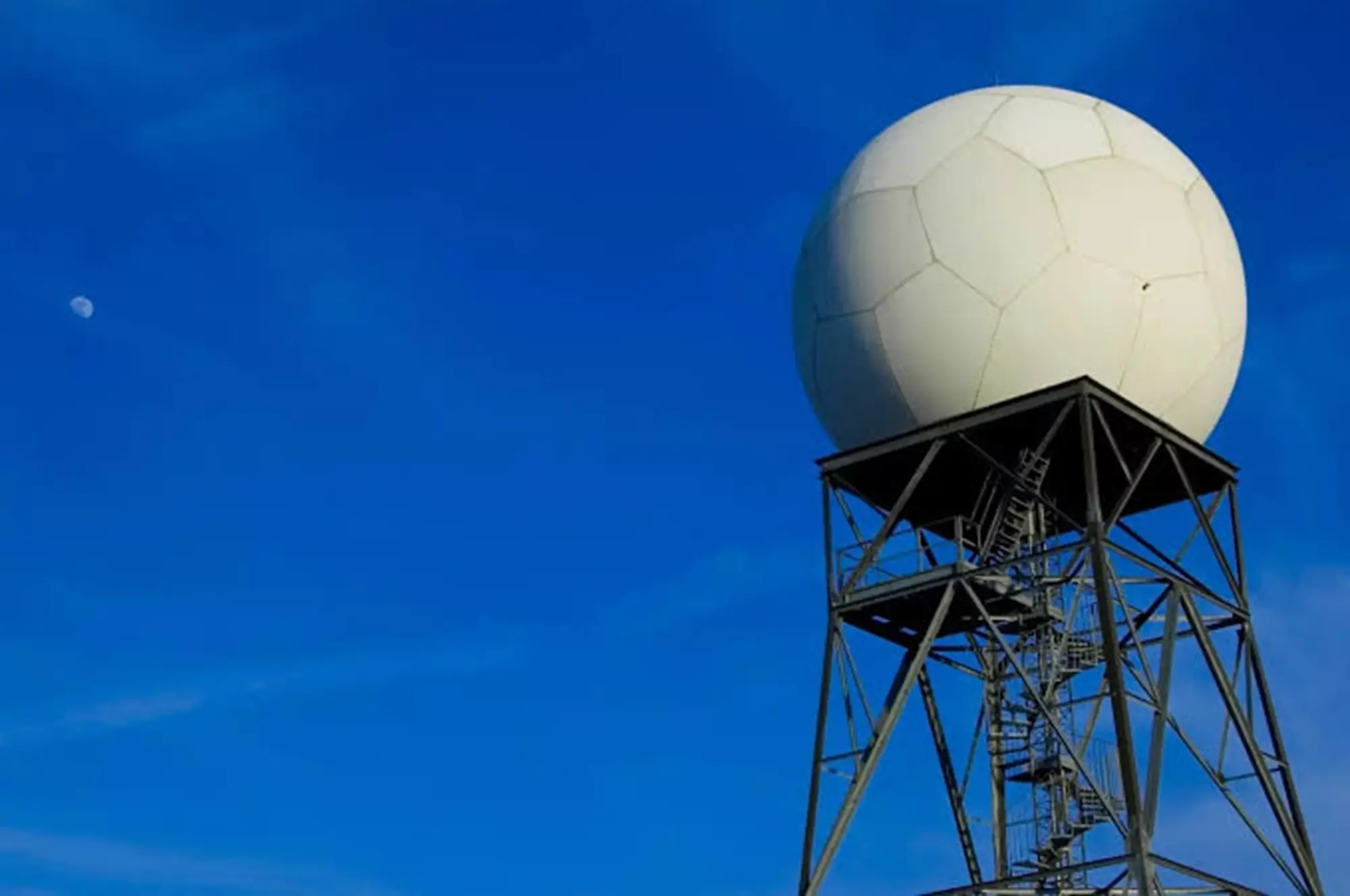
Wayanad X-Band Doppler Radar: X-Band Doppler Weather Radar to Be Installed in Wayanad; Improved Early Warnings for Heavy Rain and Cloudburst-Like Events
The India Meteorological Department (IMD) has announced the installation of an X-Band Doppler Weather Radar (DWR) at Pulpally in Wayanad to strengthen
X-Band Doppler Weather Radar to Be Installed in Wayanad; Improved Early Warnings for Heavy Rain and Cloudburst-Like Events
The India Meteorological Department (IMD) has announced the installation of an X-Band Doppler Weather Radar (DWR) at Pulpally in Wayanad to strengthen weather monitoring and improve early warnings for extreme weather events. The project is being implemented by the IMD under the Ministry of Earth Sciences (MoES), Government of India.
High-Resolution Monitoring Within a 100-km Radius
The radar will provide high-resolution weather surveillance covering an area of approximately 100 kilometres around Pulpally. It will help detect and issue timely warnings for heavy rainfall, cloudburst-like events, and other severe weather conditions, enhancing disaster preparedness in the region.
Land Provided by Pazhassi Raja College
The land required for the installation has been provided by Pazhassi Raja College, Pulpally, with coordination and support from the Kerala State Disaster Management Authority (KSDMA), according to the IMD.
Expected to Be Operational by December 2026
The IMD stated that the radar installation and related infrastructure works are in the final stages. Subject to the successful completion of all technical and operational acceptance tests, the X-Band Doppler Weather Radar is expected to be commissioned by the end of December 2026.
More Accurate Weather Forecasts and Disaster Warnings
Once operational, the radar will significantly strengthen weather observation over Wayanad and adjoining regions, enabling more accurate and timely weather forecasts and early warnings. The system is expected to benefit disaster management agencies, district administrations, and the public by improving preparedness for extreme weather events.
തിരുവോണത്തിന് പെയ്യുമോ, എങ്കില് എവിടെ, എങ്ങനെ
കേരളത്തില് ഇന്ന് പകല് ശക്തമായിരുന്ന മഴയില് വൈകിട്ടു മുതല് കുറവ്. തിരുവോണം ദിനമായ നാളെ മഴയുടെ ശക്തിയില് കുറവ് പ്രതീക്ഷിക്കുന്നു. എന്നാല് എല്ലായിടത്തും മഴ സാധ്യതയുണ്ട്. മഴക്ക് ദീര്ഘമായ ഇടവേളകള് ലഭിക്കാം. എന്നാല് ഒറ്റപ്പെട്ട ശക്തമായ മഴയും ഉണ്ടാകും.
അന്തരീക്ഷം ഇപ്പോള് എങ്ങനെ
കഴിഞ്ഞ ദിവസം ബംഗാള് ഉള്ക്കടലില് നിന്ന് കരകയറിയ ന്യൂനമര്ദം നിലവില് ജാര്ഖണ്ഡിന് മുകളിലാണുള്ളത്. കേരളത്തില് മഴ വര്ധനവിന് കാരണമാകുന്ന ചക്രവാത ചുഴികളോ, ന്യൂനമര്ദ പാത്തിയോ ഇതുവരെ ദൃശ്യമല്ല. എന്നാല് പസഫിക് സമുദ്രത്തിലെ ന്യൂനമര്ദത്തിന്റെ സ്വാധീനം തുടരുന്നുമുണ്ട്.
തിരുവോണത്തിന് എങ്ങനെ മഴ
കേരള തീരത്ത് കാറ്റിന്റെ ശക്തി കുറഞ്ഞിട്ടുണ്ട്. ദിശയിലും വ്യതിയാനമുണ്ട്. അന്തരീക്ഷത്തിന്റെ താഴ്ന്ന ഉയരങ്ങളിലെ കാറ്റ് ശക്തമല്ല. അതിനാല് ഇന്നലെ രാത്രി ലഭിച്ചതുപോലെ തുടര്ച്ചയായ ശക്തമായ മഴ പ്രതീക്ഷിക്കുന്നില്ല. എന്നാല് തെക്കന് ജില്ലകളിലില് ഇന്നു രാത്രിയും മഴയുണ്ടാകും. വടക്കന്, മധ്യ ജില്ലകളില് പുലര്ച്ചെ വരെ ഇടവേളയോടെ ഒറ്റപ്പെട്ട മഴ പ്രതീക്ഷിക്കുന്നു.
തിരുവോണത്തിന് എറണാകുളം, കോട്ടയം, പത്തനംതിട്ട, ഇടുക്കി ജില്ലകളില് ആണ് കൂടുതല് മഴ പ്രതീക്ഷിക്കുന്നത്. എന്നാല് ഇന്നത്തെ പോലെ മഴ ശക്തമാകില്ല എന്നാണ് അനുമാനം. വടക്കന്, മധ്യ, ജില്ലകളില് പകല് മഴയുണ്ടാകും. പക്ഷേ ദീര്ഘമായ ഇടവേളകള് പ്രതീക്ഷിക്കാം. കാലാവസ്ഥാ വകുപ്പ് ബുധനാഴ്ച പത്തനംതിട്ട, കോട്ടയം, എറണാകുളം, ഇടുക്കി ജില്ലകളിലാണ് മഴ സാധ്യതയെ തുടര്ന്ന് മഞ്ഞ അലര്ട്ട് നല്കിയത്.
English Summary : Weather Update: Will it Rain on Thiruvonam?. Rainfall in Kerala has started decreasing since this evening. While rain is still expected across the state on Thiruvonam day, its intensity will drop, allowing for longer dry spells alongside isolated heavy showers.